
The first stage of the Ebro Green Corridor runs along the left bank of the river, following the same route as the Ebro Nature Trail. It begins at the boundary between the municipalities of Azagra and San Adrián, and runs parallel to the River Ega.
For a stretch, walkers can follow the lovely PR-NA 209 path along the riverbank, whilst cyclists must continue along the main track. Once the two routes rejoin, the path continues through the Ebro river grove, passing 500 metres from the village of Azagra, which can be reached by taking a short detour.
The route continues through the Soto de la Marina and reaches La Barca de Azagra, a pleasant recreational area where you can relax and enjoy a picnic. The route continues, skirting several bends in the river until it reaches the chapel of San Esteban. Shortly afterwards, the route makes another large loop, following the river’s meander and passing through the groves of La Gleraza and El Puntal, after which it crosses the municipality of Funes to quickly reach Milagro.
Technical details

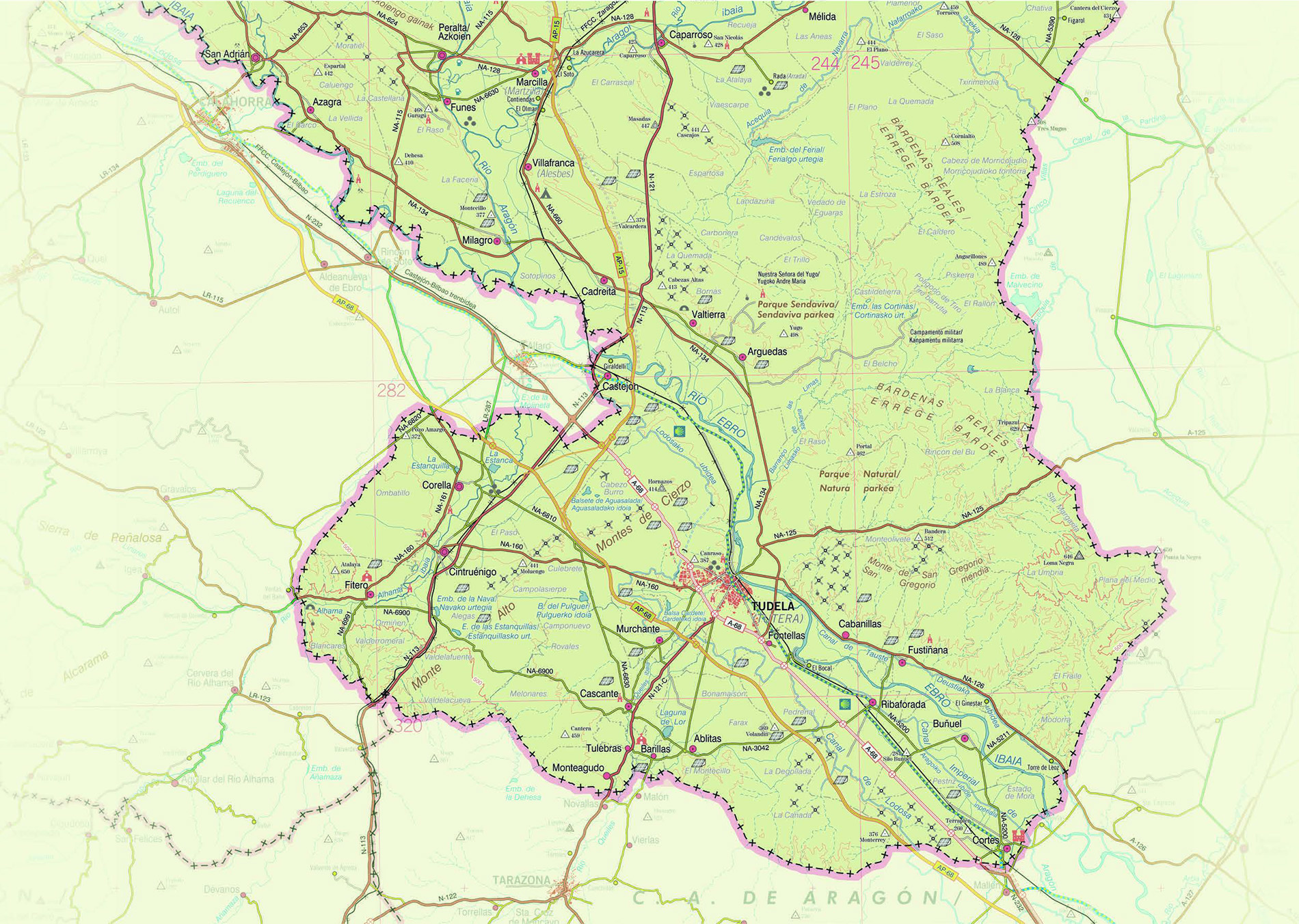


The Ebro Green Corridor in Navarre connects San Adrián with Castejón via a linear route that follows the left bank of the River Ebro and shares its route with the Ebro Nature Trail. The route begins between the rivers Ega and Ebro, and runs along a track that passes through the municipalities of Azagra, Milagro and Castejón, following the Ebro through a landscape shaped by water and the passage of time.
This section lies on fertile alluvial soil, formed by sediments such as gravel, sand and silt, deposited on both sides of the riverbed during floods. The landscape features a series of terraced slopes, reflecting the continuous sedimentation and erosion that, over thousands of years, has confined the river courses, carving out meanders in the flat areas at the bottom of the valleys. In these meanders, the oak groves are home to a rich biodiversity, particularly birdlife, which can be easily observed from the Alto del Campiel observation point in Azagra.
In the distance, the heavily eroded gypsum cliffs reveal layers of rock folded by the enormous pressure of the ancient collision between the Iberian and European tectonic plates. This process, which took place between 70 and 10 million years ago, shaped a large basin surrounded by mountains: the present-day Ebro Basin.
Along the route, you pass through natural landscapes such as the Soto de la Marina, La Barca de Azagra, and the groves of La Gleraza and El Puntal, before crossing the Special Area of Conservation (SAC) ‘Lower reaches of the Aragón and Arga rivers’. The section ends in Castejón, completing a route of great ecological, scenic and geological value.
Furthermore, the rest areas located along this section of the Corridor, in the municipalities of Azagra, Castejón and Milagro, provide a place to take a break; and, thanks to their original thematic design, offer an opportunity to learn about the importance of the history and customs linked to the traditional river crossing and the area’s railway network.